|
|
|
|
Antarctica and Islands
Today I am primarily a computational/theoretical astrophysicist which means that I largely sit in front of a computer and use computer models to try and
understand astrophysical systems. This, however, wasn't always the case and for over 3 years during the mid-1990s I worked for the South African
National Antarctic Programme (SANAP) as a physicist. This meant that I visited the South African Antarctic base a number of times and overwintered in 1994.
Overwintering meant leaving Cape Town on an icebreaker, the SA Agulhas, in early- to mid-December (in our case 1993) and returning mid- to late-January two calender
years later (1995 in our case). A long, but very rewarding experience. What's got me interested in recording some of this is that I have
finally digitised all my slides. What I have decided to do is put together a set of slideshows showing various aspect of life in the Antarctic.
The first, showing the trip south, and some of the base itself, is linked below.
Slide show showing the trip south from Cape Town,
and life at the South African base (SANAE III) in 1994.
If you've looked through the above slide show you'll have noticed how badly damaged the base was when we overwintered in 1994. This was due
to it being crushed by the surrounding ice, as in 1994 it was now 20 metres below the surface. We (SANAE 35)
were the last team to overwinter in this base (SANAE III) and it is now no longer accessible. There were no South African overwintering teams in 1995 and 1996
and so we weren't collecting any new data during these years. To try and get some new data, we started going to
Marion Island. Marion Island is at 46 S, 36 E
and is one of South Africa's two island weather stations, the other being Gough Island in the South Atlantic. Since we were doing geomagnetic research, we wanted
to get as far south as possible and so Marion Island was a pretty good spot. The slide show below shows some images of Marion Island taken during
my trip in 1996.
Slide how showing some images of the South African
base on Marion Island and some of the surrounding scenery.
There is quite a lot of wildlife in and around the Antarctic. Linked here is a
slide show showing some of the animals that I encountered on Marion Island, in the Antarctic and during my trips to and from both places.
My reason for going to the Antarctic and to Marion Island was to collect scientific data. What we were primarily interested in
was studying the Earth's ionosphere and magnetosphere, the plasma surrounding the Earth that starts at a height of about 100 km and
extends out into space. The outer boundary of the Earth's magnetosphere is essentially where the Earth's magnetic field
meets the Solar wind. We would record radio waves that would allow us to probe the structure of the Earth's magnetosphere and
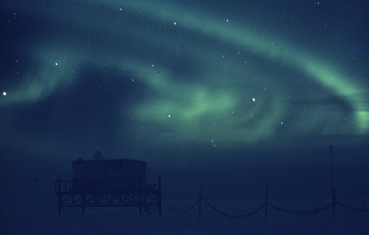
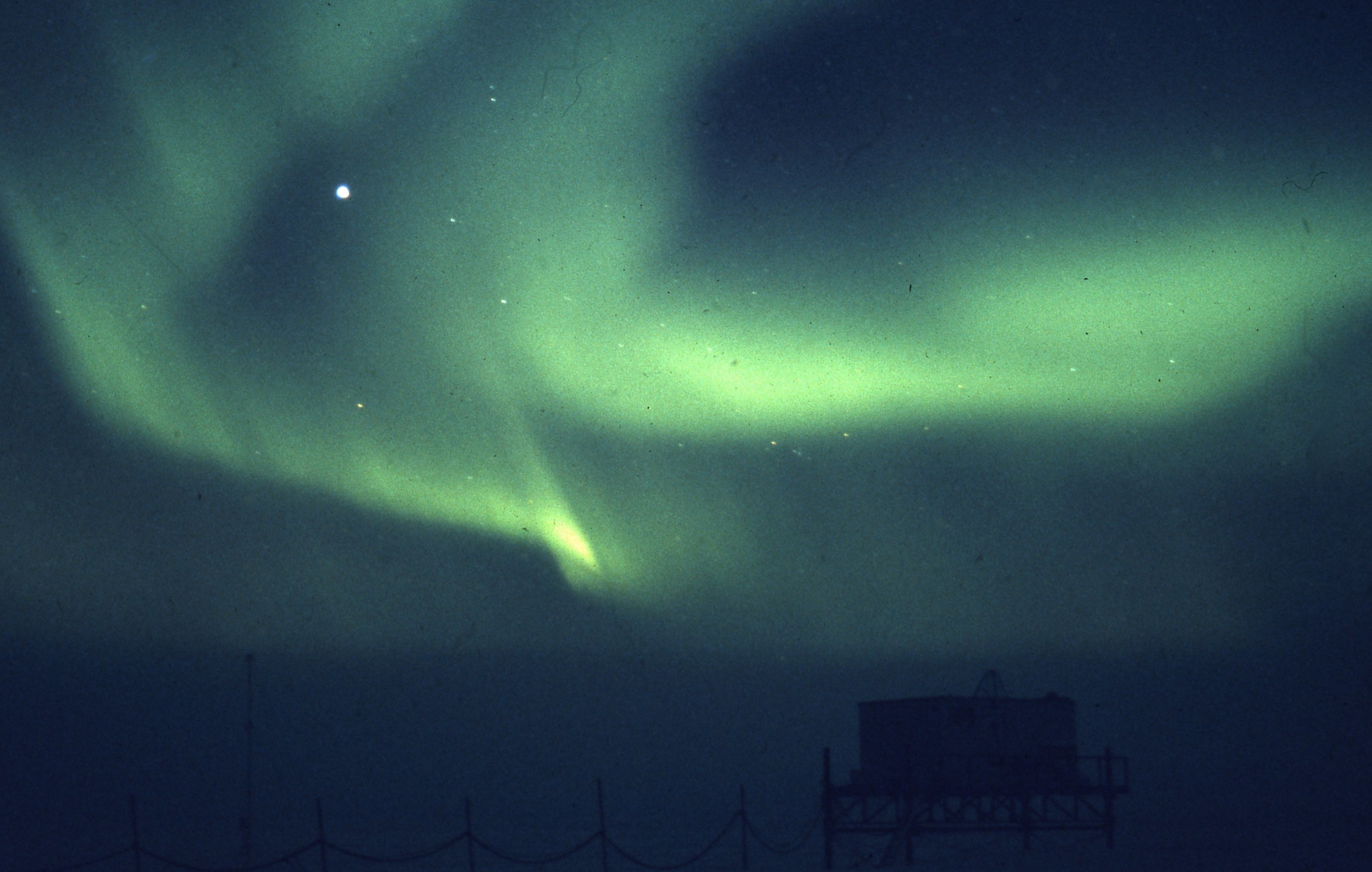
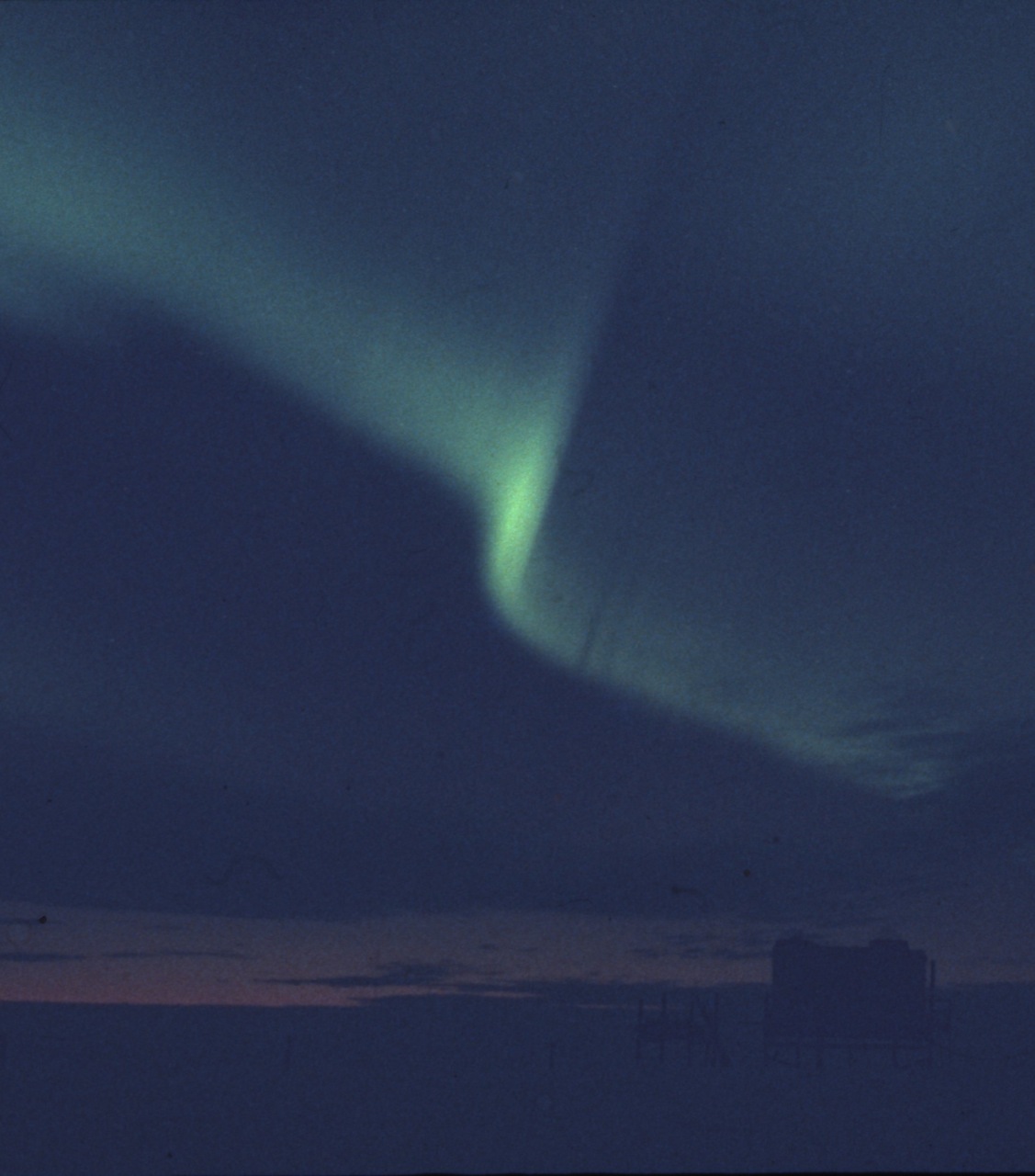
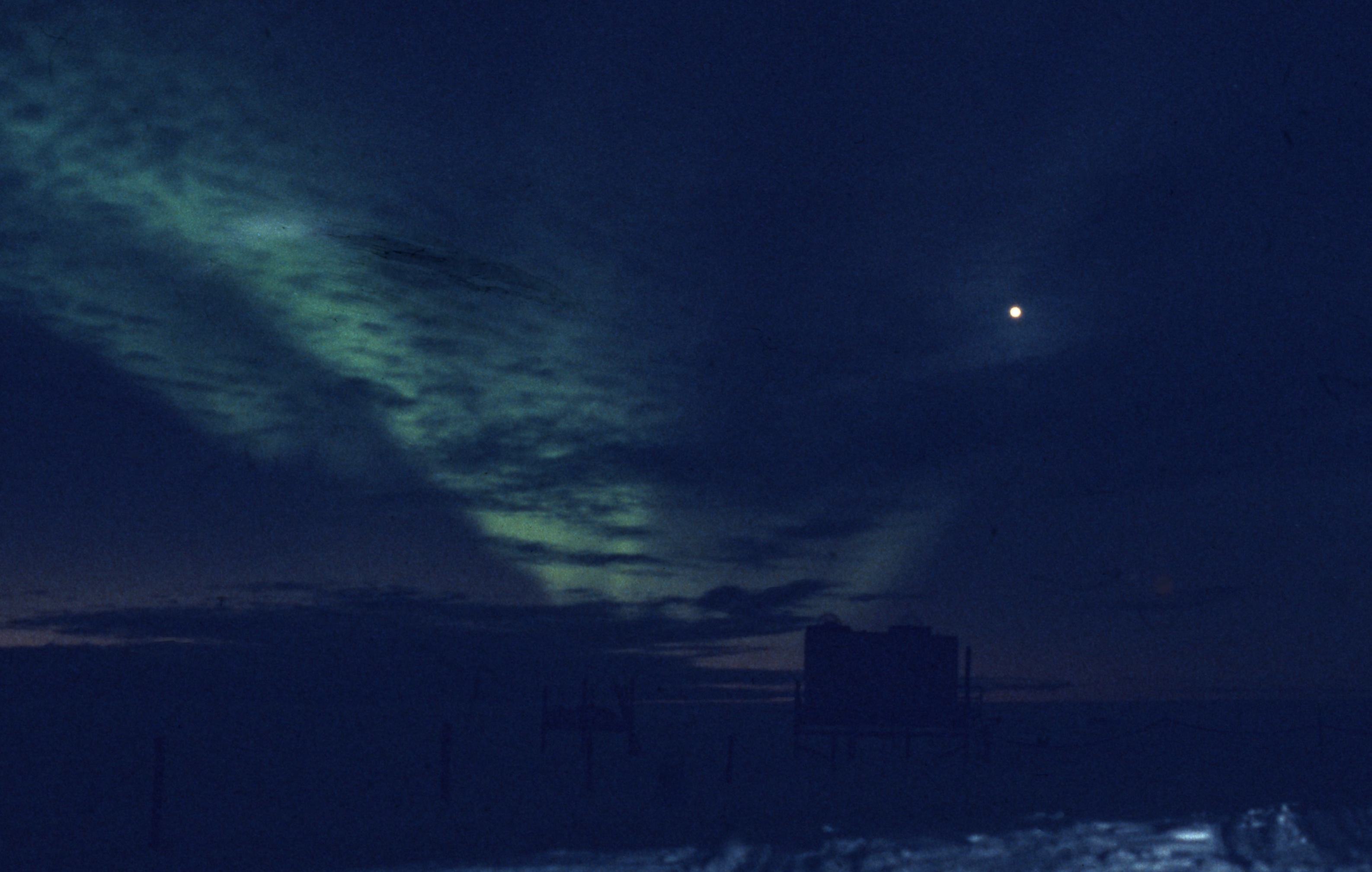
to investigate energetic events taking place in the Earth's magnetosphere. We would also record aurorae. Aurora occur
when energetic particles (normally electrons) collide with molecules in the upper atmosphere, energising the molecules which then
emit light of a particular wavelength, the colour depending on the molecules involved. An aurora would occur when material
ejected from the Sun collides with the Earth's magnetosphere. If the magnetic field in the Solar Wind was aligned in a particular
way, it could connect with the Earth's magnetic field, injecting energetic particles into the Earth's magnetosphere and these
particles would then travel along the field lines towards the Earth and would be injected into the atmosphere in the Polar regions.
Below are some auroral photographs taken during the 1994 winter.
It wasn't all work and every now and again we even had time for some fun. In the Antarctic this generally involved exploring things
like crevasses. I believe that I may have signed a contract saying that I wouldn't go down any crevasses, but minor issues
like that didn't stop us. In an attempt to prevent such things I also believe that we were not taught anything about
the correct way in which to climb in and out of crevasses which meant we didn't really know what we were doing. In fairness,
most of us had some climbing experience, so it wasn't completely irresponsible. The following
slide show is some pictures
taken mainly during the 1993/1994 summer and includes some showing what happens if you take a shortcut while driving
in the Antarctic.
My last trip to the Antarctic was in early 1997 when the new base (SANAE IV) was opened. SANAE IV is located on a
nunatak (the exposed portion of a mountain) called Vesleskarvet.
Vesleskarvet is located about 200 km from the coast and SANAE IV is the first South African base not to be on the ice shelf.
All previous bases were close to the coast and over time would be covered by snow and ice, requiring that the entrance hatches
be raised by about a metre or so every year. SANAE IV, being built on a nunatak, would remain above the surface but requires
that equipment and supplies be transported much further than would have been the case previously. This final
slide show shows, mainly, some pictures I took
during early 1997 but also includes some that I took when visiting Vesleskarvet in the 1992/1993, 1993/1994 and 1994/1995 seasons.
|
|
|
|